
KOMPSAT satellites now available for tasking
The value of BlackSky continues to increase and evolve as we add more sensor data to the online service. We recently added new satellites from the KOMPSAT family to our virtual, federated constellation.
What is KOMPSAT?
KOMPSAT (Korean Multi-Purpose Satellite) program* is a family of satellites built and operated out of South Korea and includes KOMPSAT-3A, KOMPSAT-3, KOMPSAT-2, and KOMPSAT-5. The -3A, -3, and -2 satellites carry electro-optical sensors that are capable of shooting high-resolution full-color imagery anywhere in the world. KOMPSAT-2 can shoot at 1m resolution, KOMPSAT-3 at .5m resolution, and the new KOMPSAT-3A at an incredible .4m resolution. KOMPSAT-3A just started its commercial operations a few months ago and is a state-of-the-art Very High Resolution class sensor. KOMPSAT-5 is an Earth observation SAR (Synthetic Aperture Radar) satellite system that provides up to 1m resolution imagery for geographic information applications and to monitor environmental disasters.
We are excited to offer our customers the ability to task these satellites as well as access the millions of images in the KOMPSAT archive.
The historical archive available from KOMPSAT goes back to February of 2007 and the beginnings of KOMPSAT-2. The KOMPSAT satellites have shot, at recent count, a total of 3,422,803 images since launch and are still going strong. We now have access to that entire archive via the BlackSky platform, including imagery shot earlier today. Here’s the entire archive in one view, along with imagery that’s just a few hours old:
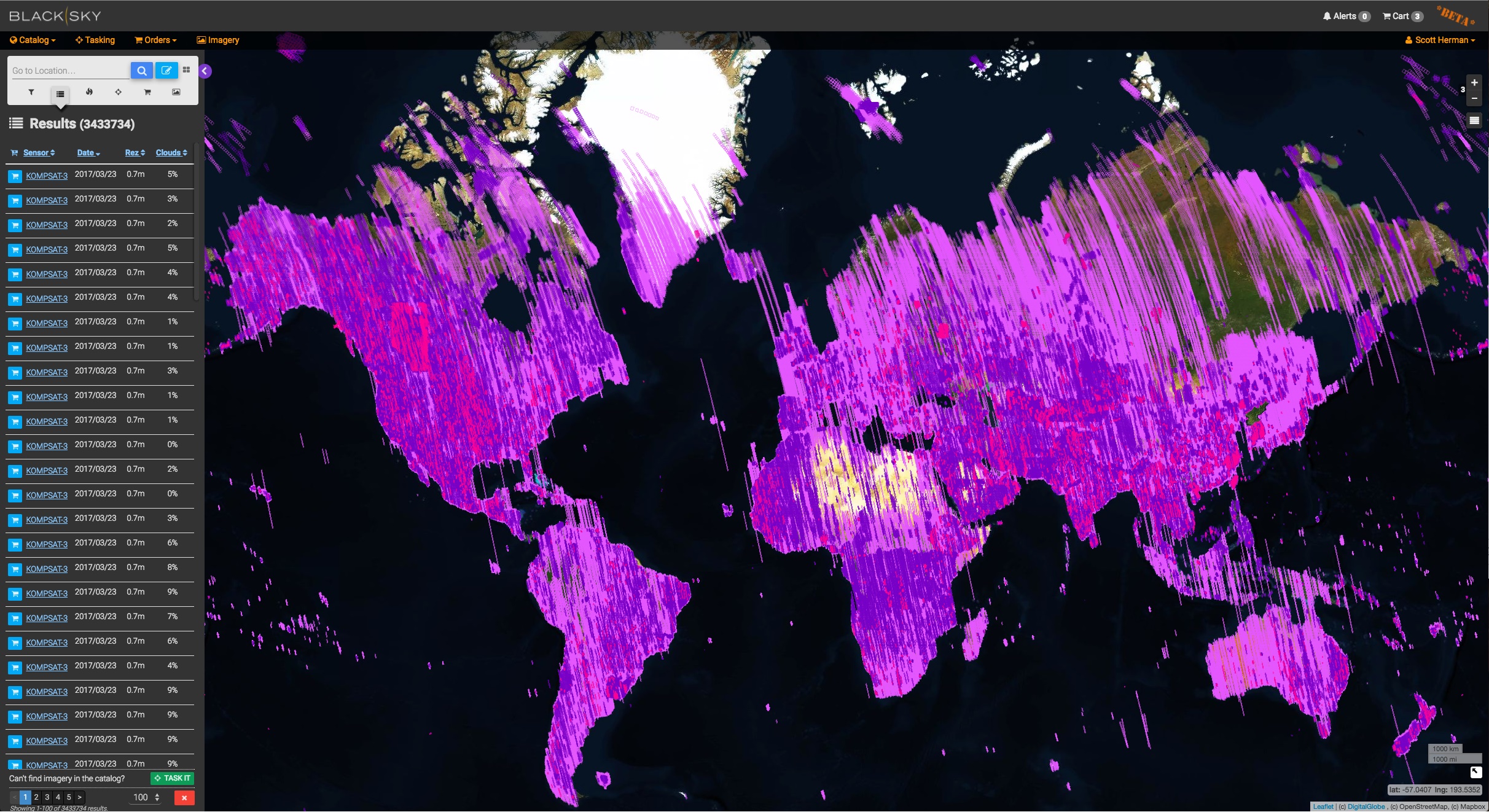
KOMPSAT comprehensive catalog coverage, including images shot earlier today…
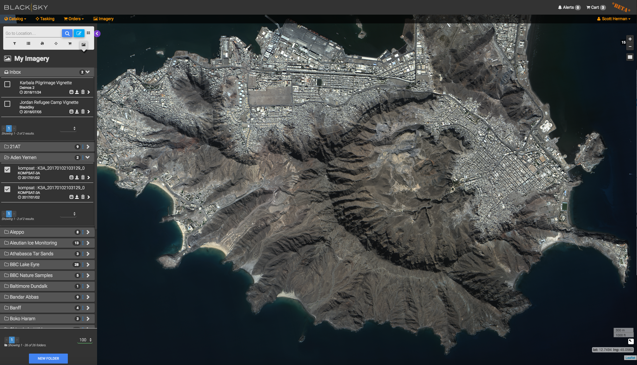
We recently used KOMPSAT-3A to focus in on the port of Aden in Yemen. We “round-trip” an order to SIIS in Korea to task and receive the imagery from KOMPSAT-3A, then we apply our own imagery processing algorithms within BlackSky to enhance the raw image and prepare it for web map visualization. Here’s an example:
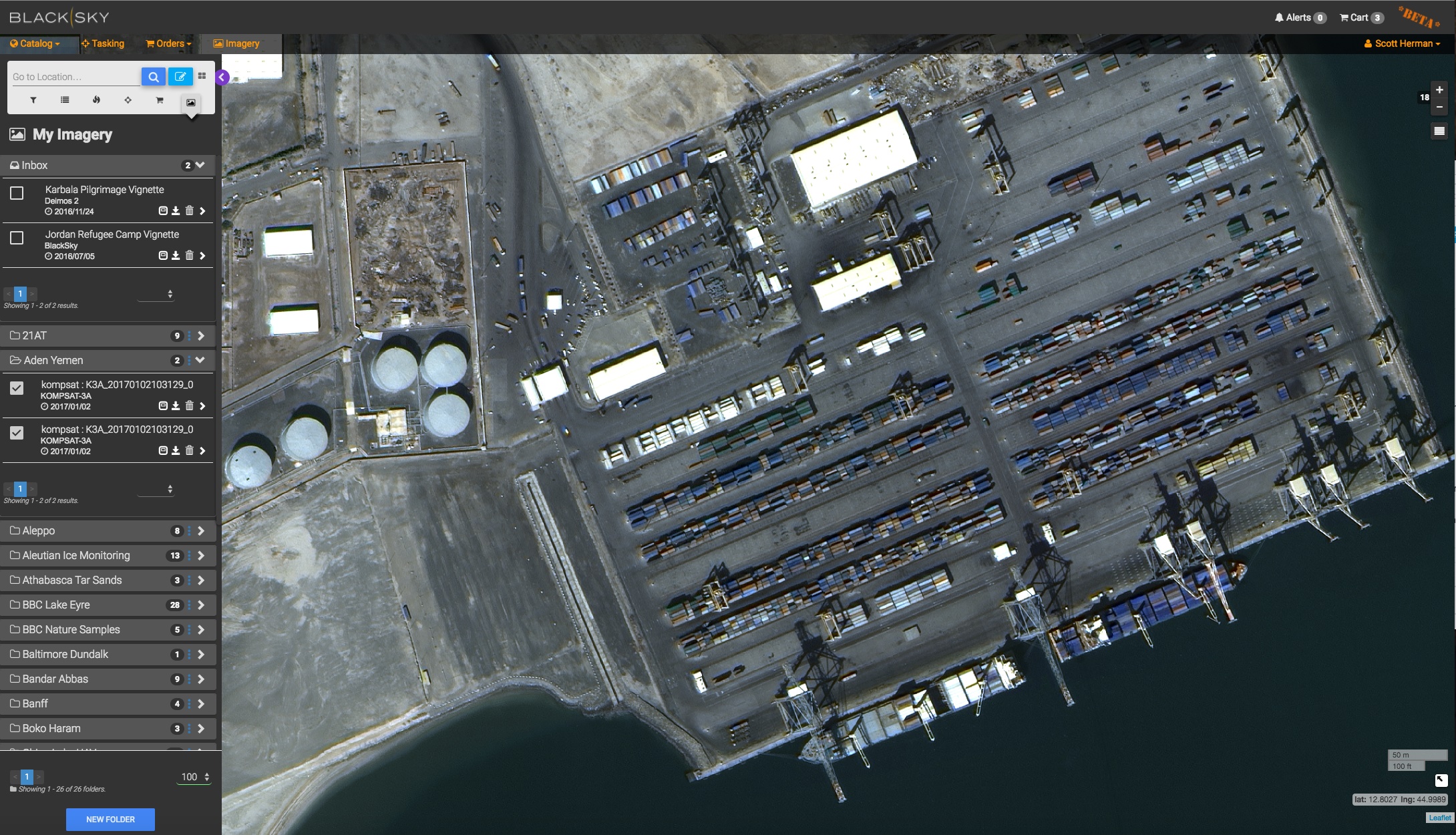
And here we’ve zoomed in further to show the resolution and quality of a KOMPSAT-3A image (keep in mind these are compressed screenshots – it looks even better in BlackSky!):
Customers can use BlackSky to task and receive imagery from a growing swarm of third-party satellites that now includes the KOMPSAT family of sensors.
We’ll continue to grow the virtual constellation over the coming months. Stay tuned!
*Korean Aerospace Research Institute (KARI) is in charge of KOMPSAT operation, and SI Imaging Services (SIIS) has worldwide exclusive distribution rights of KOMPSAT imagery.