
Rapid decision-making for fast action
Global conflict, economic uncertainty and national security threats highlight the necessity for governments and
businesses to see, understand and anticipate change so they can make fast decisions.
Governments and businesses rely on BlackSky intelligence

Gain foresight into changing
national security and
economic conditions

Secure decisive
advantage at the
tactical edge

See, understand and
anticipate change as
it happens
Obtain space-based insights
for strategic decisions
With an intuitive user interface, on-demand imagery and AI-enabled analytics, the BlackSky Spectra® platform provides users with ground truth at sites of interest around the globe.

BlackSky in the news
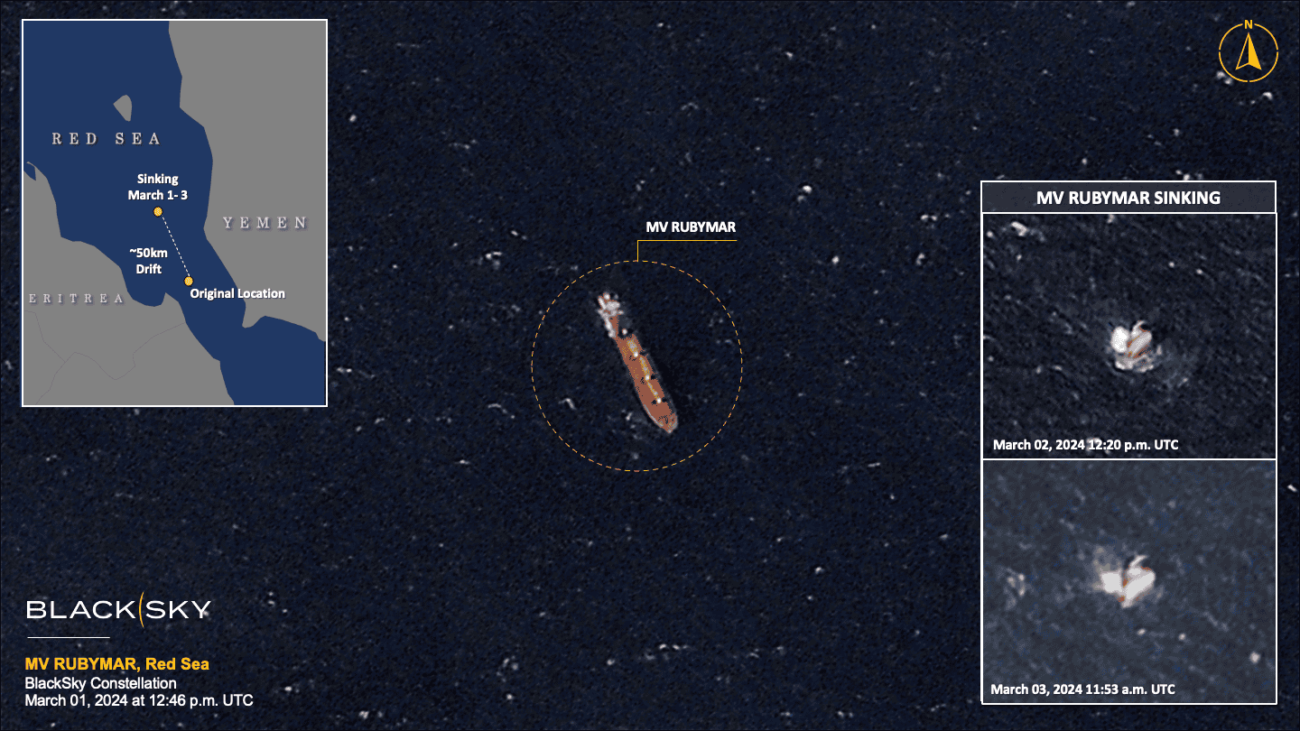
A Ghost Ship’s Doomed Journey Through the Gate of Tears
Millions lost internet service after three cables in the Red Sea were damaged. Houthi rebels deny targeting the cables, but their missile attack on a cargo ship, left adrift for months, is likely to blame.
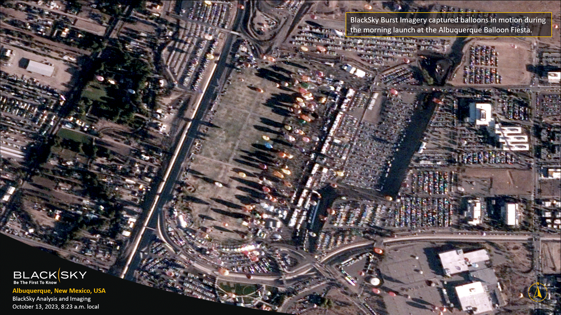
BlackSky wins defense contract to supply satellite data to train AI models
Satellite “burst images” captured in quick succession will be used to help improve accuracy of AI models to track moving targets
.
BlackSky inks $50 million deal to supply imagery services and satellites to Indonesia
BlackSky, an Earth observation and data analytics firm, will provide satellite imagery services and imaging spacecraft to the Republic of Indonesia under a $50 million deal announced Feb. 8.