Conflict and economic uncertainty are becoming widespread and pervasive. Global conflict incidents increased by 12% in 2023 compared to the previous year, with one in six people living in actively conflicted areas. Economic losses from natural disasters reached $380 billion in 2023.
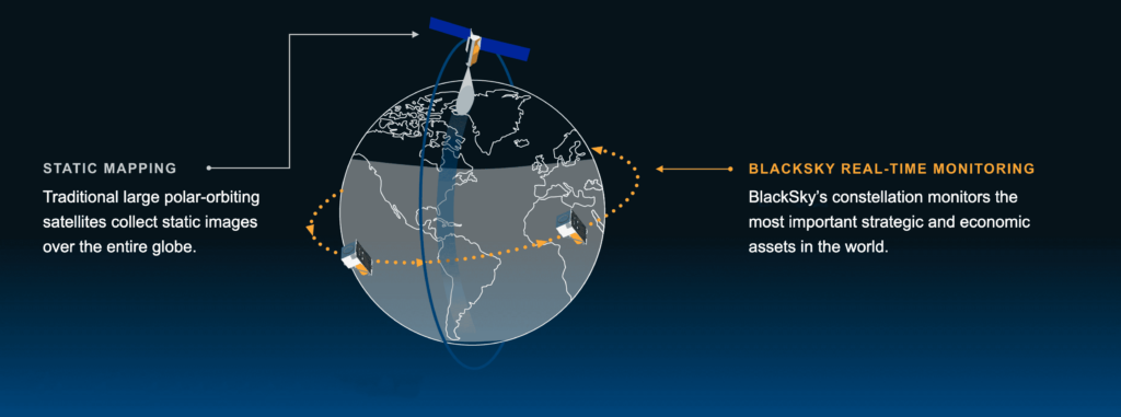
Nations have been making significant investment in Intelligence, Surveillance and Reconnaissance (ISR) to better manage conflict and instability, but traditional models are unable to keep pace. Artificial intelligence (AI) is transforming static mapping into dynamic monitoring, pivoting geospatial intelligence into space-based intelligence for strategic ISR applications.
Real-time intelligence requires a software-first mindset
Embracing a software-first mindset—as opposed to a focus only on putting advanced technology into space—is the best way for nations to secure a leadership position and realize the full value of geospatial data for ISR. A software-first mindset means having a deep commitment to automation. The global AI market is projected to reach $1.81 trillion by 2030. This market boom coincides with the accessibility of commercial space technology, including smaller payloads, more agile launch services and an overall downward trend in production costs. Automation via AI is essential for processing vast amounts of geospatial data effectively and is catalyzing the transition from static mapping to dynamic monitoring.
BlackSky prioritizes high-cadence, low-latency imagery and analytics over traditional base-mapping methods. By flying satellites in inclined orbits versus traditional polar orbits and focusing on imagining strategic areas over mapping the entire globe, BlackSky delivers actionable, real-time intelligence at machine-speed.
Operationally relevant intelligence must arrive while a mission is ongoing. BlackSky distinctly monitors key areas of interest, from dawn-to-dusk, so customers can see, understand and act not just fast, but first. This is enabled by:
- High frequency: Hourly revisit of the most important locations and assets in the world—up to 15 times per day in strategic areas.
- On-demand satellite tasking: Data is delivered 90 minutes after collection, on average, to networked and remote secure tactical terminals.
- AI-enabled object detection: Actionable intelligence on vessels, aircraft and more is delivered in near real-time via secure web domain.
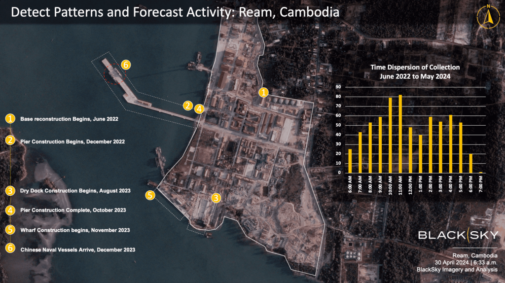
In the summer of 2022, BlackSky imagery indicated an uptick in the construction of a very large Chinese military naval station in Cambodia, despite denial of its existence. In addition to tracking its construction and completion in spring 2023, it was confirmed the main dock had the same specifications as China’s first overseas military naval station in Djibouti.
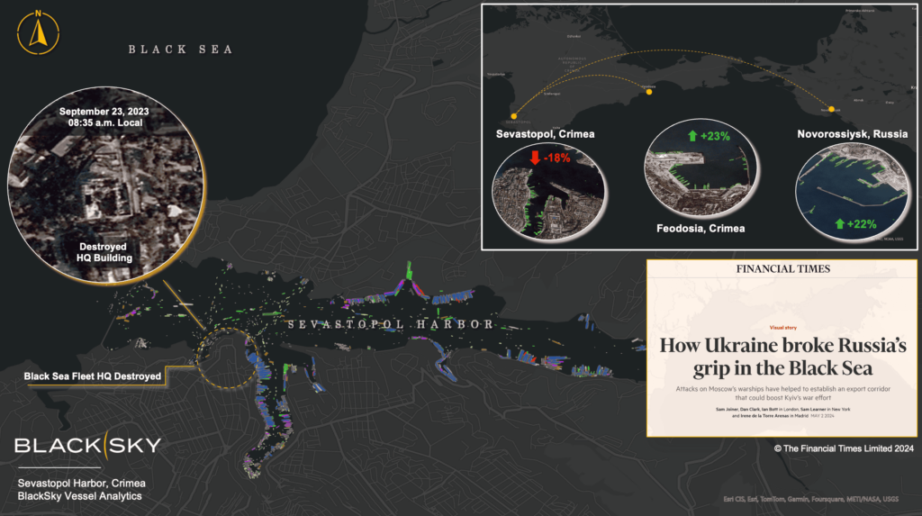
Investments in AI-driven techniques enable efficient broad area search missions. The scale of available data, even for one broad area search mission, makes it near impossible for human analysts to fully examine all historical and multi-modal data for an area of interest. By leveraging machine learning operation platforms, BlackSky analyzes historical data to identify significant changes and emerging trends, enhancing situational awareness.
A new adoption model
BlackSky’s subscription-based model provides immediate access to space-based intelligence capabilities. Customers can access BlackSky’s capabilities from any web browser — directly through the BlackSky Spectra® tasking and analytics platform or via API — to incorporate into their current workflows at the strategic and tactical level. Particularly for nations with a nascent space program, a software-first approach gives ministries of defense and intelligence organizations the ability to turn on real-time, low-latency monitoring capabilities in very little time, with very little upfront investment.
Gone are the days of using months-to-years’ old satellite images to inform critical government, military and commercial business decisions. Dynamic monitoring via AI-enabled space-based intelligence gives you the power to act not just fast, but first.
Ready to transition from static mapping to dynamic monitoring with BlackSky? We’d love to have a conversation.