
The Esri Federal GIS conference returned after a break and showcased the latest trends and advancements in Geographic Information Systems (GIS) for US government organizations. The BlackSky team exhibited at and sponsored the event, and company leadership spoke on how Esri users can depend on satellite imagery for geospatial intelligence (GEOINT).
 GEOINT is critical for government agencies and non-governmental organizations (NGOs) that need to monitor important sites in real-time, detect change, and make decisions based on up-to-date information.
The BlackSky team was excited to participate in key events at the conference:
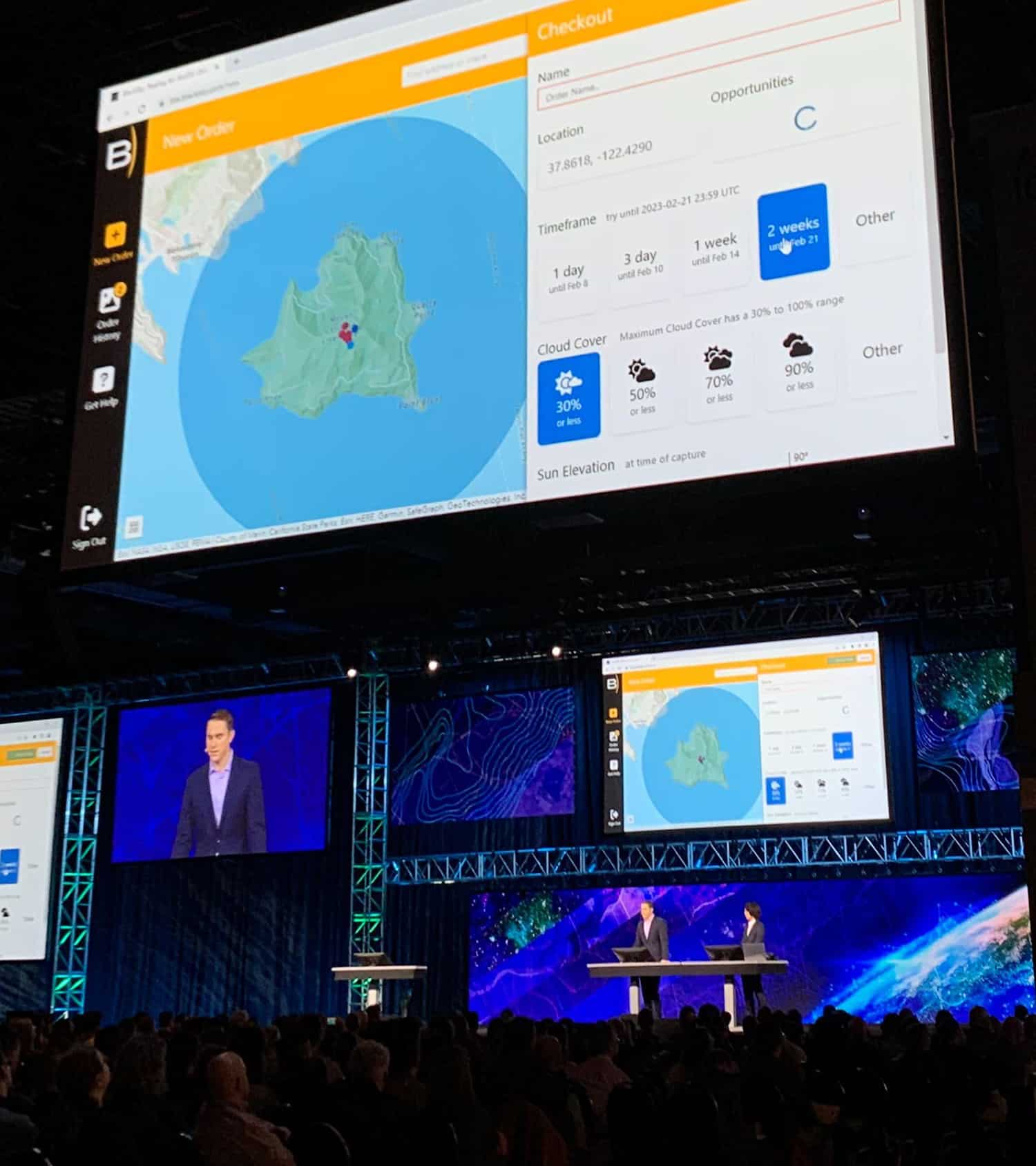
At the first day plenary session for all attendees, Esri CEO Jack Dangermond and Esri product leaders Jeremiah Johnson and Juhan Yoon demonstrated BlackSky Tasking for ArcGIS Online, the solution for satellite tasking for Esri customers. In the demo of Esri’s new ArcGIS Reality software, they fused multiple types of imagery (satellite, airborne, and drone) for 3D creation at different levels of temporal and spatial resolution. Vice Admiral Frank Whitworth, Director of National Geospatial-intelligence Agency (NGA), saw the demo, too, as mentioned in conversation with Dangermond.
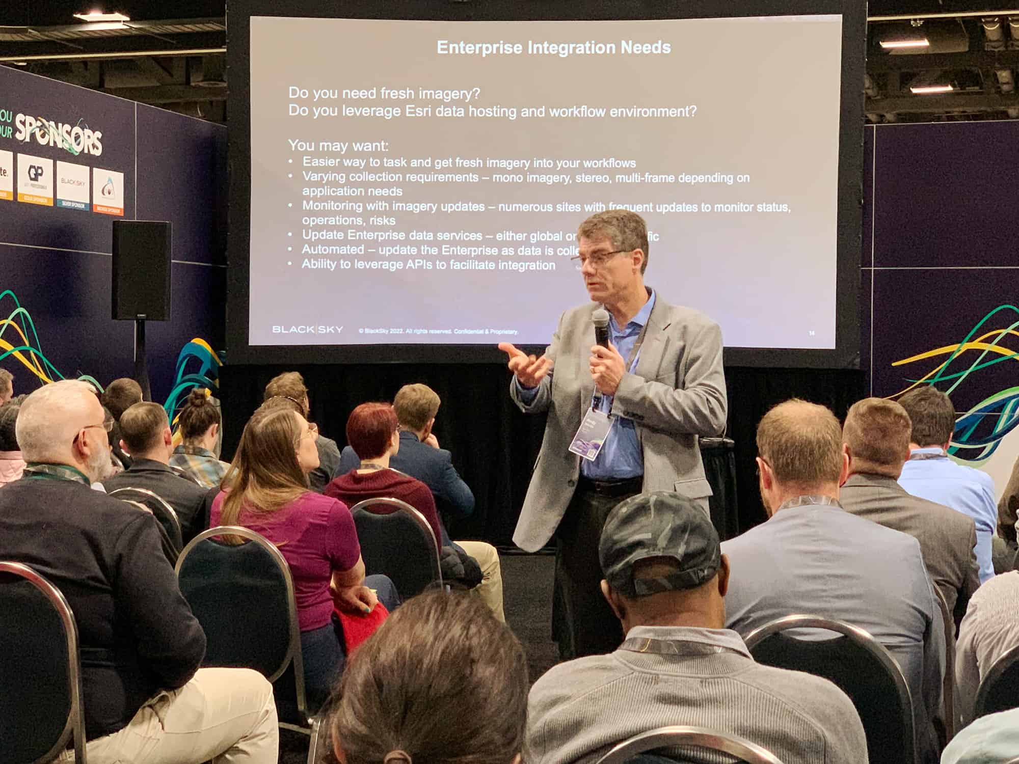 Also, the BlackSky team showed off new analysis methods in a presentation “Integrate Satellite Data in Your Pro and Enterprise Workflows.” Over 75 federal employees and other Esri users attended the talk to learn five new workflows for satellite imagery from BlackSky Senior Director of Strategic Partnerships Karl Terrey, Senior Solutions Engineer Scott Bentley, and Senior Product Manager of Platform Integrations Andy Dinville.
BlackSky’s booth at Federal GIS was active, and many representatives from defense, intelligence, and other agencies visited to ask questions about BlackSky capabilities. The team thanks all who visited and encourage you to contact us for a follow-up conversation.
Several trends emerged at the Esri Federal GIS conference. Here are our three top takeaways:
#1: Government organizations require timely access to high-quality imagery
Federal agencies have many priorities that require accurate geospatial intelligence informed by timely satellite imagery. Two top priorities we heard about repeatedly at FedGIS were national defense and security as well as natural disasters. Defense, security, and safety organizations require up-to-date information to make important decisions for national missions and public safety. Disaster response planning organizations need an updated operating picture to plan effective response when hurricanes, fires, and other disasters happen.
Satellite imagery can be critical in these efforts, providing high-resolution images and data that can help teams identify risks and track change. Defense and disaster teams benefit greatly from frequent updates delivered quickly from sources like BlackSky’s high-revisit, low-latency satellite constellation.
#2: New 3D imagery products increase situational awareness
Agencies need new solutions to visualize ground truth in 3D formats. Visualizations like digital surface models (DSMs) can be critical for situational awareness and decision-making in complex environments. Watch Esri team members use BlackSky satellite imagery to create a Digital Surface Model (DSM) for a preparedness exercise as part of Esri’s announcement of its new product ArcGIS Reality.
#3: Satellite analytic products increase operational efficiency
GIS analysts today deal with an overwhelming amount of imagery from many sources (satellite, drone, and aerial) and will work more productively by leveraging automated analytic products such as change detection, building detection, and more. BlackSky’s solutions automate detection of buildings, vessels at port, and aircraft on the ground, enabling teams to rapidly update their common operating picture. BlackSky also enables automated volumetric change detection and pattern of life analysis, both of which contribute to accurate and actionable GEOINT. Learn more about BlackSky analytic solutions.
About BlackSky’s Geospatial Intelligence Platform
BlackSky’s platform provides real-time geospatial intelligence with high revisit and low latency, which sets it apart from other commercial satellite imagery and analytic products currently available to government agencies and NGOs. This means that BlackSky can monitor a given site multiple times per day, providing up-to-date information for an accurate operating picture. BlackSky delivers imagery and analytics in an average of only 90 minutes after collection, providing a near-real-time update to its customers.
The Esri Federal GIS conference provided a great opportunity for GIS professionals in US government to come together and discuss the latest advancements in GEOINT solutions. With BlackSky geospatial intelligence for defense, intelligence, and federal civilian organizations, the potential for innovation is limitless.
If you’re interested in learning more about the latest solutions in geospatial intelligence and how they help Esri users, visit our website or reach out to our sales team. We look forward to hearing from you and learning your needs for geospatial intelligence.